 |
Horseshoe-Bend
is located in Fulton, Izard and Sharp counties in northern Arkansas. As of the 2010 census, the population was 2,184 residents. The town is named for the large "horseshoe bend" in the nearby Strawberry River. Nestled amid the Ozark Mountains, Horseshoe Bend is easily accessible to one of Arkansas' most scenic highways. It's also just 3 hours from the cities of Little Rock, Arkansas and Memphis, Tennessee. So, for a change of pace from the scenic peacefulness that Horseshoe Bend offers, a short drive will take you to the attractions of the bigger cities. However, most find that there's plenty to do right here at Horseshoe Bend. The Strawberry River offers fishing, boating and canoeing. There are also four lakes in the region, including the 640-acre Crown Lake. Horseshoe Bend is also home to a state-of-the-art 18-hole championship golf course. Other amenities include tennis, shuffleboard, miniature golf, two indoor pools, an outdoor pool on Turkey Mountains, shopping, a spa, two resorts, live music and several very good restaurants. With its located nestled in the Ozark Mountains, Horseshoe Bend is a great place to visit, or retire. Come see for yourself, and don't forget your camera - the views are spectacular.
Surrounding areas: Cherokee Village, Arkansas (14.6 mi), Hardy, Arkansas (16.8 mi), Calico Rock, Arkansas (22.1 mi), Jordan, Arkansas (23.4 mi), Norfork Lake, Arkansas (27.3 mi), Norfork, Arkansas (29.0 mi), Mountain View, Arkansas (31.8 mi)
|

|
Horseshoe Bend Vacation Rentals
|

|
|
|
|
|
Horseshoe Bend Hotels and Resorts
|
|
|
| | | Hotels & Motels |
| Cottonwood Inn | Hwy 62 East | Salem, AR | 10.3 mi. | (870) 895-4999 | | Melbourne Motel | Hwy 9 N | Melbourne, AR | 14.2 mi. | (870) 368-4355 | | Best Western Village Inn | 3587 Hwy 62-412 W | Hardy, AR | 16.8 mi. | (870) 856-2176 | | Best Western Village Inn | Hwy 62/412 | Hardy, AR | 16.8 mi. | (870) 856-2176 | | Days Inn | 4213 Hwy 621412 | Hardy, AR | 16.8 mi. | (870) 856-4241 | | Hardys Spring River Lodge | 419 Hwy 63 N | Hardy, AR | 16.8 mi. | (870) 856-4001 | | Country Inn & Suites Bentonville/Rogers | 4304 W Walnut | Rogers, AR | 22.5 mi. | (479) 633-0055 | | Super 8 Mammoth Spring Lodge | US Hwy 63 Rt 1 Box 1070 | Thayer, MO | 24.0 mi. | (417) 264-3888 | | Comfort Suites | 1227 N St Louis St | Batesville, AR | 28.3 mi. | (870) 698-1900 | | Ramada Inn | 1325 N St Louis | Batesville, AR | 28.3 mi. | (870) 698-1800 | | Super 8 Motel Batesville | 1287 N St Louis | Batesville, AR | 28.3 mi. | (870) 793-5888 |

|
Horseshoe Bend Weather & Climate
|

|
|
|
North-central Arkansas includes the Ozark Plateau, or Highlands Region, which is an area of rugged hills and deep valleys. This area is the coolest and driest part of the state. It also receives the most snow than any other part of the state, and may also receive sleet and freezing rain. This region generally receives several inches of snow each year due to the proximity to the plains states and the higher elevations. Summers are hot and humid, with frequent thunderstorms. Arkansas is known for being in the path of tornadoes. Also, while being far enough away from the coast to be safe from a direct hit from a hurricane, the state can often get the remnants of a tropical system which dumps tremendous amounts of rain in a short time and often spawns smaller tornadoes.
|
| Month |
High Temp |
Low Temp |
Rainfall |
Ocean Temp |
| January |
47°F |
21°F |
2.99 in. |
- |
| February |
53°F |
25°F |
3.03 in. |
- |
| March |
62°F |
34°F |
4.81 in. |
- |
| April |
72°F |
42°F |
4.40 in. |
- |
| May |
80°F |
53°F |
4.63 in. |
- |
| June |
88°F |
61°F |
3.47 in. |
- |
| July |
93°F |
66°F |
2.89 in. |
- |
| August |
92°F |
64°F |
2.85 in. |
- |
| September |
85°F |
56°F |
4.04 in. |
- |
| October |
75°F |
43°F |
3.47 in. |
- |
| November |
60°F |
33°F |
5.19 in. |
- |
| December |
50°F |
25°F |
4.01 in. |
- |

|
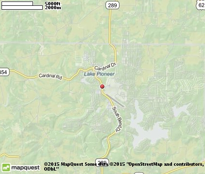
Horseshoe Bend Map & Transportation
|

|
|
 |
|
|
| Click each thumbnail image to enlarge. |
 |
|
 |
 |
The closest airports in the area are the Sharp County Regional airport (CVK) located about 11 miles east of Horseshoe Bend in Ash Flat, Arkansas, the Batesville Regional airport (BVX) located approximately 35 miles south of Horseshoe Bend in Batesville, Arkansas, the Baxter County Regional airport (BPK) located roughly 40 miles west of Horseshoe Bend in Mountain Home, Arkansas, the West Plains Municipal airport (UNO) located around 45 miles north of Horseshoe Bend in West Plains, Missouri, the Marion County Regional airport (FLP) located about 46 miles west of Horseshoe Bend in Flippin, Arkansas, the Walnut Ridge Regional airport (ARG) located approximately 47 miles east of Horseshoe Bend in Walnut Ridge, Arkansas, the Mountain View airport (MNF) located roughly 52 miles north of Horseshoe Bend in Mountain View, Missouri, the Newport Municipal airport (M19) located around 52 miles southeast of Horseshoe Bend in Newport, Arkansas, the Jonesboro Municipal airport (JBR) located about 68 miles southeast of Horseshoe Bend in Jonesboro, Arkansas, and finally the Searcy Municipal airport (SRC) located approximately 70 miles south of Horseshoe Bend in Searcy, Arkansas.
|

|
Horseshoe Bend Attractions
|

|
|
| | | Amusement and Theme Parks |
| Celebration City | Branson | MO | 85.8 mi. | | | Silver Dollar City | Branson | MO | 85.8 mi. | |
| | | Water Parks |
| White Water | Branson | MO | 85.8 mi. | | | Wild River Country | North Little Rock | AR | 104.8 mi. | |
| | | Golf Courses |
| Turkey Mountain Golf Club | Horseshoe Bend | AR | | | | Cherokee Village | Cherokee Village | AR | 14.6 mi. | | | Thayer Country Club | Thayer | MO | 23.9 mi. | |
| | | State Parks |
| Grand Gulf State Park | | MO | 22.6 mi. | | | Lake Charles State Park | | AR | 36.8 mi. | |
| | | Zoos and Aquariums |
| Dickerson Park Zoo | Springfield | MO | 108.9 mi. | |
Notice a problem with the information on this page? Please notify us.
|
Disclaimer: We recommend you conduct your own research regarding all accomodations and attractions found on this website. The distances shown on this website are straight-line distances as the crow flies. The road distance may be considerably longer. You assume all liability for use of any information found on this website. No information is confirmed or warranted in any way. By using our services you agree to the terms and conditions of this disclaimer.
|
| We are the #1 site for your Arkansas Vacation presenting arkansas vacation rentals, hotels, weather and map for each city. |
Arkansas Vacation .com
©1997-2024 All Rights Reserved.
|
|